
, Parramatta – Cyclist & Pedestrian Improvement Works – Advice of Intention to Commence Work")
Construction on the Eastern Parramatta River project is expected to begin in the second half of 2025 and be completed in early-2027. It is anticipated that the project will be undertaken in multiple stages depending on the successful tenderers for the delivery program.
The $2 billion Western Sydney Infrastructure Grants Program (formerly known as WestInvest) is funding transformational infrastructure projects across Western Sydney. Funded projects will improve the liveability of communities and support economic recovery, making a real difference to the quality of life in 15 Local Government Areas in the region.
For more information see https://www.nsw.gov.au/grants-and-funding/western-sydney-infrastructure-grants-program.
The $9M Eastern Parramatta River project is being funded by the NSW Government in association with the City of Parramatta.
The vision for the Eastern Parramatta River project is to improve the capacity, safety and amenity of the foreshore paths whilst responding to the surrounding environment. The project will undergo rigorous planning processes including the preparation of a Review of Environmental Factors for the five project sites.
Prepared by environmental specialists, this legislative planning instrument means that plant and animal species will be documented, any protection zones identified, and clear construction parameters specified to ensure minimal footprint and impact on the environment including habitat and fragile saltmarsh and mangrove areas.
The focus of the Eastern Parramatta River project is to celebrate the green corridor that is the Parramatta River. The goal is to increase connectivity along the river and to some of our larger parks and green spaces.
By providing the community with more access to the City’s natural and ecological drawcards, and highlighting their significant cultural heritage value, Council looks to create more opportunities for people to embrace walking and riding as transport and leisure and enjoy more of the tree-lined river foreshore.
The alignment of the proposed pathways will carefully endeavour to minimise any tree removal. Additional tree planting will be proposed at each site to offset any required removals.
More tree planting will be proposed to reinforce the green corridor and provide important shade cover for users.
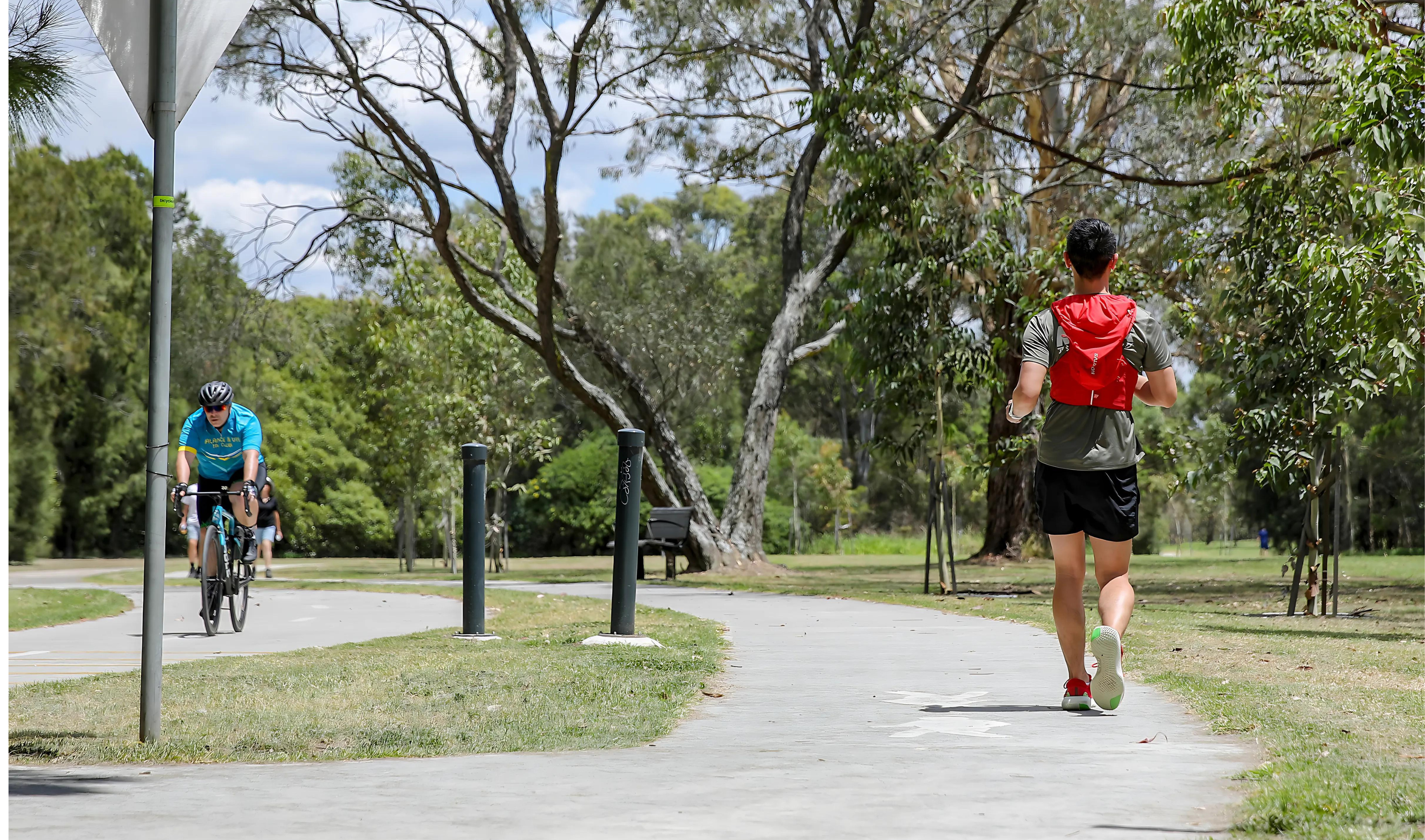
Council has installed signs and decals along shared paths highlighting the shared path and appropriate sides for cyclists and pedestrians.
City of Parramatta has also promoted the Polite Path program that reminds cyclists to ring their bell on approach and to slow down when pedestrians are about.
Pedestrians are also reminded to keep to the left of a shared path and ensure that if they have a dog, it is not impacting the enjoyment of others.
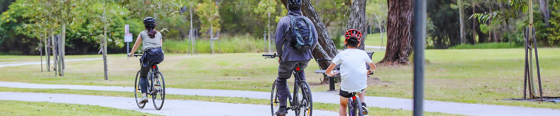
While the Parramatta Valley Cycleway (PVC) has been delivered over 35 years in stages since 1991, patronage has grown exponentially in the last five to six years with the completion of some of the final stages. This is largely due to how safe it feels to be completely off-road.
Our community embraces active transport and benefits from improved physical and mental health outcomes when provided with safe opportunities to walk in nature and to ride along paths separate from traffic.
In each location of the Eastern Parramatta River project, the paths are a combination of shared and separated paths, depending on the context.
Through the larger reserves where space allows and the main movement is along the river, separated pedestrian and cyclist paths are proposed. However, in locations like the centre of Royal Shores, there are destinations both sides of the path that create cross movement, and Council is encouraging cyclists to slow down by retaining the shared path. Any pedestrians who do not want to share space with cyclists will have access to an exclusive pedestrian path.
Based on a vision of providing more public access to the Parramatta foreshore and offering a picturesque riverside journey connecting many CBD visitor destinations, the Eastern Parramatta River project will capitalise on the popularity of the Parramatta Valley Cycleway and deliver 2.8km of improved pedestrian and cyclist paths alongside the Parramatta River. Upgrades to paths and amenities will be provided at five key locations:
- Rangihou Reserve, Parramatta.
- Baludarri Wetlands, Parramatta
- Reid Park, Rydalmere
- Royal Shores, Ermington
- George Kendall Riverside Park, Ermington.
Installing either a wider shared path or separate paths for pedestrians and cyclists, the project will improve safety and amenity along the foreshore. The expanded paths will also accommodate more visitors.
Planned eco-LED lighting will increase safety along the paths but also protect against light spill into the sensitive bushland areas at Baludarri Wetlands. The new lighting will support increased use of the foreshore pathways closer to the CBD, particularly for pedestrians.
Planned for completion in early-2027, this $9 million project is funded by the NSW Government’s Western Sydney Infrastructure Grants Program, in association with the City of Parramatta.
The western half of George Kendall Riverside Park currently has a 3m-wide shared path along the foreshore alongside other recreational facilities, picnic tables and good tree coverage. Among the proposed upgrades are:
- Construction of separated pedestrian and cyclist paths for 275m through the park
- Grass restoration and landscaping, including native tree planting to revitalise the park
- Additional seating will also be provided.
Royal Shores currently has a 4m-wide path and a large number of mature trees. The concept design for Royal Shores includes:
- Separate pedestrian and cyclist paths on approach to Royal Shores (east and west) with a new lightweight bridge over the western creek.
- At the centre of Royal Shores, there are destinations on both sides of the path that create cross movement, including picnic and BBQ facilities on the riverside. Council is encouraging cyclists to slow down by retaining the shared path alongside additional educational line marking. Any pedestrians who do not want to share space with cyclists will have access to a new exclusive pedestrian path to the north.
- The path from George Kendall Riverside Park down to Royal Shores will be re-aligned and re-graded to improve accessibility and sightlines.
- Realignment of pathways where possible to maximise green turfed open space for informal play.
Download the Royal Shores Cycleway & Pedestrian Pathway Concept Plan.
Reid Park currently has 3m paths used by pedestrians and cyclists, regenerated bush between the path and river, as well as a select number of trees to the north. The proposed upgrade includes:
- Separated pedestrian and cyclist paths are proposed for 300m through the park
- Additional native tree planting alongside the path.
Download the Reid Park Separated Cycleway Concept Plan.
Baludarri Wetlands currently offers a 3m-wide path and boardwalks for visitors to enjoy a range of nature experiences including coastal salt marsh, freshwater wetlands, habitats for migratory birds, a mangrove area, and native and non-native plants. The proposed upgrade includes:
- LED lighting will be installed in the handrail on both sections of the existing boardwalk. Eco-friendly lighting will provide light to make the path visible and ensure minimal light spill into the surrounding wetland or bushland, protecting local fauna.
- LEDs will also light the steps leading from Pemberton Street to the existing shared pathway within the Baludarri Wetland.
- Along the existing concrete shared pathway, LED light poles will be installed. The lights will be collared and will provide minimal light spill into the surrounding bushland and wetland areas.
Download the Baludari Wetlands Lighting Concept Plan.
Currently, Rangihou Reserve has a 3m wide shared path with scattered large trees scattered throughout the site with a larger stand at the eastern end towards the Alfred Street Bridge. The proposed upgrade includes:
- Widening the existing shared path to a 5m-wide foreshore promenade for 450m
- Installing light poles around the intersection of Morton Street and Baludarri Drive
- A short section of boardwalk will be introduced to respond to localised low-level flooding and to retain existing large trees
- Additional native tree planting and bush regeneration works
Download the Rangihou Reserve Shared Pathway Concept Plan.