Council has undertaken a significant amount of compliance activities in the area to support the implementation of new parking restrictions, ensure road rules are followed and help to minimise event impacts on residents. In the 2025 calendar year, a total of 703 infringements were issued in Newington, predominantly during events. Over 500 infringements were issued for vehicles obstructing pedestrian ramps or stopping on footpaths and nature strips. Additionally, more than 100 infringements were issued for 'No Parking' and 'No Stopping' offences, including parking within 10 metres of an intersection.
You can find a summary of past consultations in the Report to Council June 2026 (in the attachment section), or view more information via the link below.

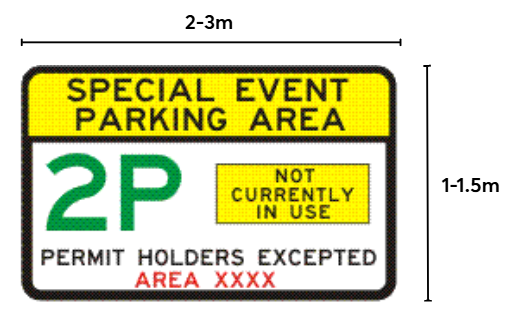
There are two types of SEPS signs.
Entry signs will be installed at six entry points to the SEPS area. These larger signs (either 1 m × 2 m or 1.5 m × 3 m) include changeable time plates to show when SEPS is in operation.
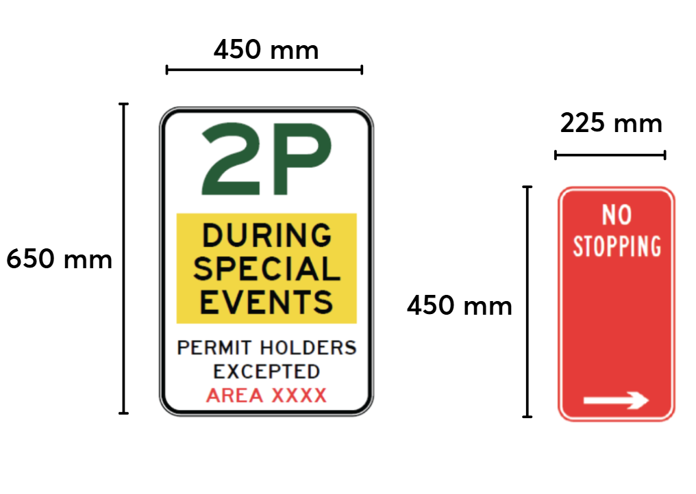
Repeater signs will be placed along local streets. These are smaller (650 mm × 450 mm) and remind drivers that they are in a SEPS area and a 2-hour parking limit will apply when SEPS is activated. See below for a size comparison with a standard No Stopping sign.
To clearly inform drivers and support enforcement under NSW Road Rules, all 467 signs are needed. Repeater signs need to be placed regularly along streets (at least every 200 metres) and after key points such as intersections or roundabouts to ensure they are easy to see and understand.